
The elevation at the top is 6125 feet, and while I was able to park fairly close, I climbed the last 700 feet in 0.68 mile (approximately 20% gradient). The distance as the crow flies from my car to the top was only 0.3 mile, but there's no way I was going hike straight up a 45% gradient. I zigzagged, and it was hard enough!
The view from the top, though...
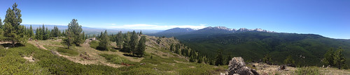
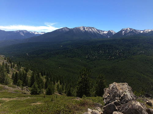
Wow. So completely worth it. A full 360-degree view of the Elkhorn and Eagle Cap ranges.
I was a happy hiker.
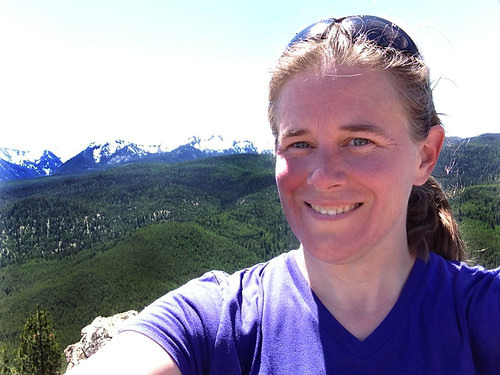
Tired and sweaty, but completely happy. Being out in nature revitalizes me.
I was hiking alone today, and while that's not without risks, it gives me an incredible sense of peace. I don't have to talk to anyone, I can go at my own pace, I can watch the birds, and listen to the beautiful nature-silence.
I enjoy the feeling of self-reliance that I get by being out in the middle of nowhere and knowing that I can take care of myself. There was no trail to the top, I had to bushwhack it. While I did have the aid of my GPS unit, I also had a compass and a map, and I know how to use them. I found the cache at the top of the mountain, and most importantly, I found my way back down the mountain to my car. I did let a neighbor know where I was going before I left, in case something went horribly wrong.
It took me over an hour to climb up, but only 20 minutes to get back down!
I love geocaching.
No comments:
Post a Comment